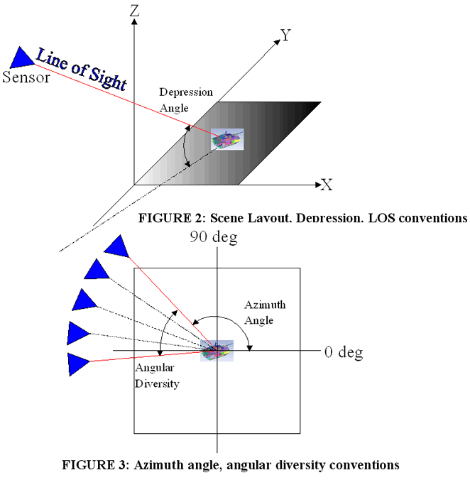

This simulated data is derived from publicly purchased models of military vehicles. The models are converted into point-clouds, simulating the data that would be acquired by actual LADAR sensors. The pristine sample data provided is limited in that it represents a view from the sensor with an angular diversity of 60° in 15° increments (five perfectly registered looks). These five looks are taken at three different resolutions – accomplished by simulating a change in distance from the image to the sensor. The three sensor-to-scene distances utilized for this challenge problem were 100 meters, 500 meters, and 1000 meters. No effort was made to simulate dropped points from system imperfections, color, or surface finish (this sample data can be considered to be pristine).
Data for this challenge problem has been created using the software package IRMA. The IRMA program was used to sample the facet models into a point-cloud image that simulates the LADAR data. The simulated viewing distance from the sensor to the target is re-iterated at 100 meters, 500 meters, and 1000 meters to provide three different resolutions within this sample of LADAR data. The data for this challenge problem is simulated with a depression angle of 45 degrees (refer to Figure 2). The nominal azimuth is 0 degrees with data ranging from -30° to 30° sampled in 15° increments (5 looks) (refer to Figure 3).

This data product is available for immediate DOWNLOAD.